 Slovenec (1934): Mednarodna ekspedicija naskakuje Himalajo
 Hettie Dyhrenfurth ...
Letošnje poletje je naskočila Himalajo mednarodna ekspedicija, katero je vodil prof. Dyhrenfurth. Člani ekspedicije so iz svojega taborišča 5100 m visoko poslali v Evropo pismeno sporočilo, pisano meseca avgusta.
Iz tega poročila posnemamo: Ekspedicija je skoraj končana. Danes je bil takorekoč zadnji dan, ko smo včeraj zaradi strašnih viharjev morali prenehati naskoke 400 metrov pod vrhom gore Hidden Peak. Morda ga pojutrišnjem naskočimo še od druge strani, a uspeha si ne obetamo, ker je vreme strašno slabo in pa, ker tudi naše zdravje ni več tako, ko v začetku.
52 dni smo taborili 6300 do 7700 metrov visoko ter smo 40 dni prestajali grozovite viharje monsuma. Taki se zdimo sami sebi, kakor stari, izmozgani frontni vojaki. Želimo si le počitka, svežega perila, sveže hrane im sadja.
Odpotovali smo precej kasno ter smo v 44 dneh prišli v Basecamp pod Hiddenom, kateri je več ko 8000 metrov visok, in ki smo ga hoteli osvojiti. Odločili smo se, da pojdemo nanj po južnovzhodnem grebenu.
Dne 24. junija smo začeli in smo na grebenu prišli 6200 metrov visoko. Greben pa je visok 6900 metrov, nato pride smučarski teren do 7600 m, nazadnje lahki robovi. Hidden je torej lahak ... Ampak! Nosači so se nam uprli, češ, da ne gredo po tej poti ne za denar ne za vse Mohamedove hareme. Penili smo se od jeze. Zato smo hoteli Hidden naskočiti s sedla Convay. Pot tja pa je v zračni črti dolga 13 km v višinah do 7000 m. In zopet smo krenili s taborišči kvišku. Izkušeni himalajski plezalci so nam sicer prerokovali, da jo bomo polomili, ker nas bo zadržal monsum. Kaj je monsum, tega gole besede ne morejo dopovedati. Enkrat te zakida v sneg, da bi se skoraj zadušil, drugič pometa okrog tebe, da misliš, zdaj-zdaj bo odneslo še tebe in šotor.
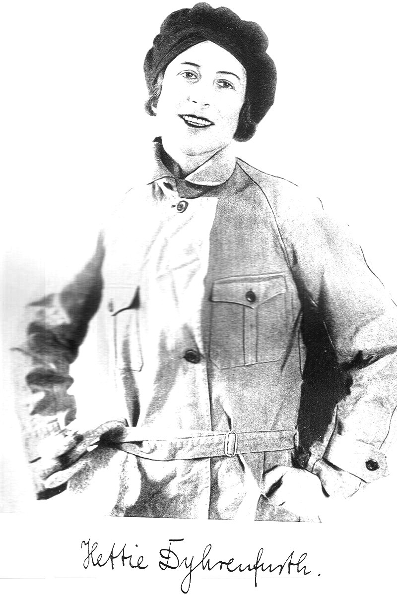 Vendar smo dosegli štiri gore po 7000 m. Do višine 7550 m na vrh Convay Peaka smo spravili celo ženo našega voditelja. Gospa bi bila seveda blaženo izdihnila, toda s potrebnimi tabletami smo ji korenito pomagali. Tako je ona sedaj najbolj sloveča hribolazka na svetu z absolutnim ženskim rekordom, saj je priplezala 7550 m visoko. Pri vsem tem pa niti ni vajena gora in tudi sama ni hotela. Šla je le na naše prigovarjanje. Ob strašnem vremenu smo 11. in 12. avgusta prekoračili glavni vrh Queen Mary Peaka, ki je 7775 metrov visok. To je najvišji himalajski vrh, ki je doslej nanj stopila človeška noga. Pri vsem tem so se nam vsem vneli še mandlji in bi bili morali počivati. Ker je zrak trd zgoraj, treba vedno dihati skozi usta, in tako nastajajo nevšečnosti, ki pa niso nevarne, ker je zrak brez bacilov.
Sedaj romamo navzdol. Že več tednov nismo menjali svežega perila. Čas je že, da svoje srajce in spodnje hlače z ušmi vred pomečemo v prepade ledenika Baltoro. Še tri tedne poti je pred nami, preden pridemo med civilizirane ljudi.
Slovenec, 6. oktober 1934
Himlayan journal 7/1935
THE KARAKORAM1
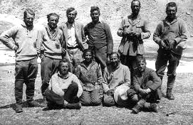
An International expedition organized by Professor G. O. Dyhren- furth visited the upper Baltoro glacier during 1934. It was mainly financed by the film industry, so that their energies were largely concentrated on this particular side of the enterprise. The organization comprised two sections, a mountaineering group and a film group. The Mountaineering group was composed as follows: Professor Dyhren- furth, leader, film director, geologist; Frau Hettie Dyhrenfurth, transport officer; Marcel Kurz (Neuchatel), topographer; Dr. Hans Winzeler (Schaffhausen), physician; Andre Roch (Geneva); James Belaieff (Paris); Hans Ertl (Munich); Albert Hocht (Munich); Ghiglione (Torino), newspaper reporter to Gazetta del Popolo. The Film group comprised Gustav Diessl (Vienna), chief actor; Jarmila Marton (U.S.A.), actress; Andrew Mar ton (Berlin), director; Richard Angst (Zurich), chief operator; Fritz von Friedl (Berlin), assistant operator.
The party left Srinagar on the 13th May, and by way of the Zoji La reached Skardu on the 28th. Marcel Kurz, the topographer, who had gone ahead, was found laid up in the bungalow with a bad knee following a riding accident, and most unfortunately had to give up his part in the expedition. Five days after leaving Askole the party reached Ordokas (13,900 feet),2 the well-known grazing-ground at the side of the Baltoro glacier, almost due north of Masherbrum, which has previously been the depot camp of almost all expeditions to these parts. The third day after leaving Ordokas the party reached 'Concordia', where the two large head feeders, the Godwin- Austen and the Vigne glaciers, unite with the upper Baltoro, now often called the Abruzzi glacier.3
1 Owing to pressure of work Professor Dyhrenfurth was unable to prepare a full account of his expedition for the Himalayan Journal until February. At the end of that month, after the first part of the Journal had gone to press, I received, through the kindness of Frau Dyhrenfurth, a very rough translation of her husband's paper, with the request that proofs should be sent to her for examination. As this would have delayed the appearance of the Journal considerably, I have decided that it would be best to summarize from the rough account sent by Frau Dyhrenfurth.—Ed.
2 This place is variously spelt by different travellers, Rdokas, Urdukass, Ordo- kass, &c. The Dyhrenfurths spell it Rodokas and give a height of 4,057 m. (— 13,320 feet). I have given above the name and height from the Survey of India map 52A.
3 Concordia' was first surveyed by Godwin-Austen in 1861; the map was improved by Conway in 1891; and the whole region as far as the foot of Golden Throne was surveyed in considerable detail by photogrammetry on the Duke of the
Dyhrenfurth had planned to place his base camp about eight miles south-east of Concordia on a moraine of the Abruzzi glacier, and the vanguard of the expedition established the base here on the 23rd June. While Frau Dyhrenfurth remained in charge of this camp, reconnaissances were undertaken in various directions. The most important of these were of the southern approaches to Gasherbrum I (the 'Hidden Peak' of Lord Conway), 26,470 feet, and of the approaches to Conway's Saddle, at the head of the glacier, to which they give the height 6,300 m. (= 20,685 feet) following Desio's map. During the same time Ghiglione reconnoitred the Chogolisa Saddle between Golden Throne and Bride Peak.
The approach to Gasherbrum I was reconnoitred by Dyhrenfurth and Roch. They report great difficulty in finding a way through the very crevassed surface of the Gasherbrum glacier which descends from the great cirque of Gasherbrum summits, two of which are over 8,000 m. and possibly five others above 7,000 m.1 They reached a point at 6,250 m. ( = 20,520 feet) before turning back. There appeared to be no possible route by which Gasherbrum I could be climbed from this side, both the north-western ridge and the western face being terribly steep and quite impossible. On the last day of this reconnaissance the climbing took ten hours and the return was only begun in the late afternoon; the party was benighted and had to wait till the moon rose. Camp was only reached at 3.20 in the morning.
Dyhrenfurth suggests that the best route is by a huge rock and ice ridge which leads directly to the snowfields beneath the summit of Gasherbrum I. From the brief notes sent me it is not clear whether he means the south or south-west ridge. According to Desio's map both are very steep, difficult, and exposed. Ertl and Roch climbed it to about 6,300 m. ( = 20,685 feet), and were convinced that with the aid of ropes and pitons coolies could be taken up. The coolies, however, thought otherwise; and not being trained men in the same sense as those Sherpas and Bhutias who have tackled the other great Himalayan mountains, it is hardly surprising that they were unwilling to make the experiment. It was naturally most disappointing to the expedition to have to abandon what they considered the route offering the most promise of success.
Abruzzi's expedition of 1909, and extended by stereo-photogrammetry during the Duke of Spoleto's expedition of 1929. On the latter expedition the Duke himself, with Sig. Ponti and the guide Croux, camped at Conway's Saddle, overlooking the Kondus glacier to the south (Geographical Journal, vol. Ixxv, 1930, p. 391). The Duke's altimeter gave 20,000 feet as the height of the Saddle (ibid., p. 392). Desio's map shows only broken form lines in this area.
1 Burrard gives the following heights for the four triangulated summits of Gasherbrum, from east to west: I: 26,470 feet ( = 8,062 m.); II: 26,360 feet (=8,028 m.); Ill: 26,090 feet (= 7,946 m.); IV: 26,180 feet (== 7,974 m.). Desio's map gives for the same peaks, 8,068 m., 8,035 m-? 7,952 m., 7,925 m. In addition, Desio has two heights on the southernridge of Gasherbrum I over 7,000 m. (7,069 m. and 7,504 m.) which can hardly be regarded as separate peaks, one height at the eastern end of the summit ridge of Gasherbrum II, 7,772 m., which again is not a separate peak, and two outliers on the great southern spur of Gasherbrum IV, 7,321 m. and 7,003 m. which are definitely distinct peaks.
It was now decided to pitch a camp on the Conway Saddle, and to push up one camp after another along the great south-east ridge of Gasherbrum I. This meant a gradual approach, from a height of over 20,000 feet, of about eight miles of ridge with great differences of height, several lesser summits, and much very broken ice. There was really very little chance of success by this route from the start, though the actual difficulties for the coolies were less, provided the weather remained fine.
Unfortunately other difficulties now had to be met. Winzeler and Belaieff had caught some form of malaria infection in Skardu and were slow in recovering. Roch had therefore to remain in the base- camp while these members of the party were ill. Dyhrenfurth himself was also kept there for some time owing to the film work. On the 29th June Ertl and Hocht pitched the first camp on the Conway Saddle. Most of the coolies suffered from the altitude and had to be sent back almost at once. Ertl and Hocht had therefore to reconnoitre the route to Camp 7 (the first along the ridge leading northeastwards from the saddle). An ice-wall, about 600 feet high was made practicable for coolies by fixing ropes, and the route was now free from obstacles to Camp 7. Six coolies only could be induced to carry to this spot. When at last on the 6th July everything was ready for another move forward—after five weeks of fine weather—a violent snowstorm set in, which buried the tents under four feet of snow. This was the same break in the weather which brought disaster to the Nanga Parbat expedition. After five days of storm the Conway Saddle Camp had to be evacuated, and any attempt after this on a 26,000-feet peak became out of the question.
The film group worked for two days on the Conway Saddle. Acting and filming under such conditions cannot be much fun and the group shortly afterwards retired to the monasteries of Ladakh. On the 30th July Professor and Frau Dyhrenfurth, with Ertl and Hocht, returned to Camp 7 beyond the Conway Saddle, intending to make an attempt to climb Queen Mary Peak,[1] while Belaieff, Ghi- glione, Roch, and Winzeler tackled the Golden Throne. On the morning of the 2nd August, which was brilliantly fine, Ertl, Hocht, and a coolie named Hakim Beg, on one rope, and Dyhrenfurth, his wife, and the coolie Roji on another, cut steps and prepared a track towards the Queen Mary group. At about 7,100 m. or 23,310 feet by aneroid, the party returned to Camp 7. The next day was again fine, and, taking advantage of the route prepared the previous day, the two parties made rapid progress to about 23,000 feet, when clouds began to come up from the south-west. The going now became very arduous, the climbers sinking into the soft snow to their waists. The depression between the central and western summits was reached, and from here the western summit was climbed by 3 p.m., in a snowstorm. In his account Dyhrenfurth says: 'The barometer shows 7,580 m., 50 m. too high after my calculation later on. The real height of this summit of Queen Mary must be 7,530 m. or 24,705 feet.’ The descent to Camp 7 was made in a snowstorm. On the same day, the 3rd August, the other party reached the eastern summit of Golden Throne, to which Dyhrenfurth gives the height of 7,250 m.
It was now time for Dyhrenfurth to get down to Ladakh for further film work. Ertl and Hocht remained behind for a few days and on the 12th August climbed the central, east, and main summits of the Queen Mary group. Starting from Camp 7 at 2 a.m. they reached the dip below the central summit at 8 a.m. Here the coolie, Hakim Beg, who was feeling the effects of altitude, was left with food and warm clothing. From the central summit Ertl and Hocht climbed the east summit, and then, after crossing a broad snow plateau, reached the main summit at 4 p.m. On the last rocks, some 30 feet below the snow-capped summit, a cairn was erected with the records of the ascent. The party then returned to the central summit and reached Camp 7 at 8 p.m.
The above details have been summarized from a rough translation of Dyhrenfurth's notes by his wife. Without wishing to detract from the merit of the achievements of the expedition, it is necessary to add that there must be some uncertainty regarding the actual heights of the various summits of the Queen Mary group, until that group has been surveyed in detail. Only one summit has been triangulated, and it is reasonable to imagine that this is the highest of the group. The triangulation was carried out by Mr. Grant Peterkin, a very capable surveyor trained at the Royal Geographical Society, who accompanied the Workmans on their expedition to the Siachen in 1912. The results were checked in London. This triangulation was based on and extended from five triangulated peaks of the Survey of India net.1 The position and height of the Queen Mary summit are given as 350 39' 51", 76° 45' 43", 24,350 feet. We do not know definitely to which summit this refers, the scale of the Workman's map is too small to show the detailed topography of the various summits, and the summit region was not explored. On the other hand, in her account before the Royal Geographical Society, delivered on the 24th November 1913, Mrs. Bullock Workman stated definitely that the highest of the group has a height of 24,350 feet.1
1 See 'Note on the Construction of the Map of the Siachen Glacier', by C. Grant Peterkin, in Geographical Journal, vol. xliii, 1914, pp. 140-1.
This evidence is supported by other trigonometrical observations. Mr. V. D. B. Collins, of the Survey of India, was sent up in 1911 to triangulate the high peaks at the head of the Siachen basin. No summit of over 25,000 feet was found in this group. It seems unlikely that the earlier triangulators in the 'fifties of last century, as well as Collins in 1911, would have missed a summit of over 25,000 feet. It is possible that the photographs taken on the Duke of the Abruzzi's expedition might have missed such a summit; but hardly likely that those of the Duke of Spoleto's expedition should have done so. Members of that expedition camped three miles south-west and three miles north-north-east of Queen Mary, without suggesting that a summit over 25,000 feet existed.
It is, however, only fair to Professor Dyhrenfurth, with whom I have been in correspondence on the subject since the heights were first published in the press, to give his view of the question.
'According to your letter, Queen Mary Peak has been triangulated on the Bullock Workman expedition in 1912 from three points; all these points lay on the Siachen side. On the Duke of Spoleto's expedition the mountain was not re-triangulated. On all former maps, the topography of the Queen Mary massif is shown entirely wrong, as the highest summit is shown throughout as the eastern one, the outpost against the Siachen glacier, from which a ridge descends steeply westward. In reality this west ridge contains the central summit and the western summit, which is higher than the eastern. The central summit is lower than the eastern. According to the new Desio map, the western summit is only 6,700 m. high, that is, only 400 or 500 m. higher than the Conway Saddle. In fact the western summit is at least 7,430 m. high, or according to our observations, 7,530 m.
'The eastern summit is therefore the only point so far triangulated; the main summit lies rather far backward, beyond a broad plateaulike declivity. Up to now this main summit has not been triangulated, either by trigonometrical or photogrammetrical means. It is 250 m. higher than the eastern summit.
1 See 'The Exploration of the Siachen or Rose Glacier, Eastern Karakoram', by F. Bullock Workman, in Geographical Journal vol. xliii, 1914, p. 133.
'Considering the triangulation of Peterkin as correct, we obtain the following heights:1
Eastern summit . . 24,350 feet 7,424 m.
Central summit . c. 24,190 feet 7,375 m.
Western summit . . c. 24,370 feet 7,430 m.
Main summit . . £.25,174 feet 7,675 m.
'These are minimum heights, which according to our observations do not correspond to reality. As far as we could observe, the real heights are—
Eastern summit . . 24,682 feet 7,525 m.
Central summit . . 24,518 feet 7,475 m.
Western summit .. 24,705 feet 7,530 m.
Main summit . . 25,502 feet 7,775 m.
'These are already corrected aneroid readings. On the western summit the aneroid indicated 7,580 m. We subtracted 50 m. because the weather changed for the worse during the day and the atmospheric pressure had fallen by the equivalent of 50 m. I fully realize the doubtful value of aneroid readings. In the case of Queen Mary we did not base our statement upon a single observation, but on repeated examination by two aneroids and on three different days. Moreover we always compared the results with those of Camp 7 and of the Conway Saddle, where we had a large camp for 52 days, as you know. The height of this Saddle has been indicated by Desio as 6,300 m. Our Camp 6 was about 40 m. below the top of the pass; as a precaution I always assumed 6,250 m. as the height of Camp 6.5
Professor Dyhrenfurth goes on to say that he attaches still more importance to the fact that on the 3rd August they reached the height of Golden Throne on Queen Mary two hours before they reached the western summit of Queen Mary, that when they were at the summit they were far higher than Golden Throne, whose height is 7,312 m., and that photographs taken from the central, that is, the lowest of the four Queen Mary summits, show that even this is far higher than Golden Throne.
Such evidence will no doubt convince many that there is a 25,000- feet peak in the group. I have, however, myself been so deceived by the vagaries of an aneroid, finding it register incorrectly by a thousand feet at high altitudes without any apparent change of the barometer at a lower station, or any change of weather on the mountain; I have been so often deceived by estimates of whether I was higher or lower than the summit of a neighbouring mountain; and I have so often found that evidence based on such observations is insufficient for proof, that I cannot yet convince myself that any summit of the group exceeds 25,000 feet.
1 This is, of course, on the assumption that the triangulation data refers to the eastern summit.